
Golden ZIP Code Coverage
Golden’s practical ZIP code directory context has four distinct entries. Two ZIPs serve street-address geography with Golden mailing labels. The other two are PO-box and institutional contexts.
| ZIP | Areas Covered | Post Office | Notes |
|---|---|---|---|
| 80401 | Downtown Golden and many street-address deliveries | Downtown Golden Post Office, 619 12th Street, Golden, CO 80401-9996 | Core Golden mailing ZIP; the city line does not equal the ZIP. |
| 80403 | Golden mailing addresses in northern, foothill, and nearby areas | Verify the exact street with USPS | Includes city and substantial unincorporated Jefferson County territory. |
| 80402 | Golden-associated PO Box and delivery use | Verify with USPS city and ZIP mode | The local scope guide identifies it as PO Boxes only; do not treat it as a street roster. |
| 80419 | County-government and institutional mailing context | Verify the exact address with USPS | Appears in county material; it is not a general city-limit street ZIP. |
Use the rows as different search paths. For 80401 and 80403, pair the ZIP with a street or parcel. For 80402, first ask whether the record is a box. For 80419, preserve the institutional role instead of counting it as ordinary city-resident geography.
- ZIP and ZIP+4
- ZIP identifies a delivery area; the four extra digits refine a delivery route or segment.
- PO-box ZIP
- A postal context centered on boxes rather than a normal street-address parcel area.
- Unique ZIP
- A ZIP assigned to one organization or delivery point rather than a broad neighborhood.
- Carrier route
- A delivery path within a ZIP; it does not establish a city boundary or household membership.
Find Golden Residents by ZIP
A ZIP search verifies delivery with USPS, filters the Assessor by city and postal code, checks GIS boundaries, and uses voter data only within required fields. A ZIP code directory begins with the USPS ZIP Code Lookup, which is the final delivery-format check when a county city or postal field does not agree with a supplied address. It offers three routes.
- By Address: Company is optional; Street Address is required; Apt/Suite is optional; City and State are required; ZIP is optional.
- By City and State: enter the city and state to review the postal context tied to that place name.
- Cities by ZIP: enter a ZIP to see the city or place label associated with that delivery area.
The USPS result standardizes an address. It does not confirm that a person or company is at that address. ZIP+4 is a delivery refinement, so retain the address-level result and the date checked rather than treating the extra digits as a residence signal.
The USPS lookup source shown in the manifest captures the By Address view and its alternate city and ZIP paths; a verified live Golden result was not retained.
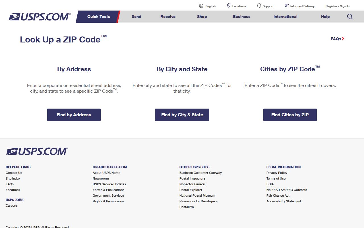
Use the captured field pattern to format a check, then save the returned delivery label with the date. A post office or sorting facility address is not proof of a neighborhood ZIP.
Search Golden ZIPs in the Assessor
The Jefferson County Assessor Property Records Search is the strongest local ZIP-capable parcel route. For a ZIP code directory, its address form requires City and Postal Code selections, and the visible list includes GOLDEN plus 80401, 80402, 80403, and 80419. The search is county-wide, so a Golden mailing city can still describe land outside the incorporated city.
| Field | Type | Required | Golden use or format |
|---|---|---|---|
| Address Number | Text | No | Example format: 12345. |
| Pre-directional | Dropdown | No | E, N, NW, S, SE, SW, or W. |
| Street Name | Text | No | Enter the name, such as Main. |
| Street Type | Dropdown | Template-required | Use the street type list, such as ST, RD, AVE, or WAY. |
| Unit Number | Text | No | Use when the address has a unit. |
| City | Dropdown | Yes in address mode | Select GOLDEN from the county list. |
| Postal Code | Dropdown | Yes in address mode | Visible values include 80401, 80402, 80403, and 80419; verify the current list. |
Address results show Property Address, City, Postal Code, PIN, AIN, TAG, Owner, Property Class, and Mailing Address. Pages hold up to 50 rows and include paging and export controls. Record those fields before moving to the parcel detail. The Assessor supplies a useful ownership and parcel lead, not a title certification or proof that a person occupies the property.
Golden ZIPs and City Limits
ZIP code boundaries are delivery areas, while city limits are municipal geometry. Golden’s 80401 and 80403 context includes substantial unincorporated Jefferson County territory that keeps a Golden mailing label. A record that says “Golden, CO” can therefore describe a postal place without describing a Golden tax jurisdiction.
The City of Golden City_Limits service supports query and GeoJSON work, but its boundary is for general planning and is not survey-accurate. Compare it with Jefferson jMap, the assessor city, and the parcel TAG or tax district.
A Golden ZIP Boundary Check
A repeatable ZIP code check keeps ZIP research from turning into a false city roster. Keep the address, parcel, postal, and voter questions separate as each source is consulted.
- Run USPS By Address with the exact street, city, state, and optional ZIP. Save the standardized result and the date checked.
- Run the Assessor address search with City set to GOLDEN and the relevant postal code. Record situs or property address and mailing address as separate fields.
- Open Jefferson County jMap and compare its city or county boundary layers with the City of Golden service.
- Keep the parcel PIN, AIN, TAG, and legal description. Those identifiers are a stronger bridge than a street number when a label or address changes.
- For a registration question, use the Colorado voter lookup with first name, last name, ZIP, and birthday. If a move causes no match, try the last home ZIP and contact Elections rather than guessing.
The voter lookup is not a vote-choice tool. Confidential voters and people under 18 may not locate through the public form, and a missing result is not proof that a person is unregistered. County voter files can carry public address, party, status, precinct, and birth-year fields, while sensitive fields and confidential records are withheld.
Golden Mailing vs Situs
The mailing-versus-situs split is one of Golden’s clearest parcel clues. A ZIP code can describe delivery while the situs identifies land. In the researched Assessor sample, 2117 Ford St, Golden, was the situs address, while the recorded owner’s mailing address was 12600 W Colfax Ave B-400 Ste, Lakewood. The first identifies the land. The second identifies where correspondence was sent. Neither field alone proves where a person lives.
- Situs address
- The physical parcel or property address used by the assessor, GIS, and address-linked city records.
- Mailing address
- The address used for tax or property correspondence, which may belong to an organization or representative.
- PIN or AIN
- The parcel identifiers that let the Assessor, GIS, and Recorder records stay tied to the same land.
- TAG
- The assessor tax-district field used with city and boundary checks.
If an exemption or homestead field appears on a parcel card, it may be an occupancy clue, but it remains tax-classification evidence. Pair a parcel result with the legal description and, when needed, the Recorder index rather than turning an owner field into a household claim.
Golden ZIP 80402 PO Box Myth
Myth: every ZIP in a Golden mailing result can be searched as a physical street roster. The Golden History Museum collection-scope guide identifies 80402 as PO Boxes only, which makes it a different kind of ZIP code context from a street-address parcel area.
Verify current treatment for a particular box or mail address with USPS. Use the Cities by ZIP mode and the mail-address field, then stop short of inferring a physical parcel or household when the record supplies only a box designation.
Practical tip. Treat 80402 as a delivery clue first, and require an independently matched situs address before starting parcel research.
Golden ZIP 80419 Myth
Myth: 80419 belongs in the same street-address bucket as Golden’s ordinary ZIPs. County material places 100 Jefferson County Parkway with Golden, CO 80419. That is a government mailing example, not an automatic city-resident ZIP or a general city-limit street ZIP. Check the exact address with USPS and preserve its agency or facility context.
The Colorado Division of Real Estate print-detail route shown in the manifest is another useful caution. It identifies the Table Rock association at W 58th Avenue, Golden, CO 80403, showing how an organization record can carry a Golden ZIP without serving as a resident list.
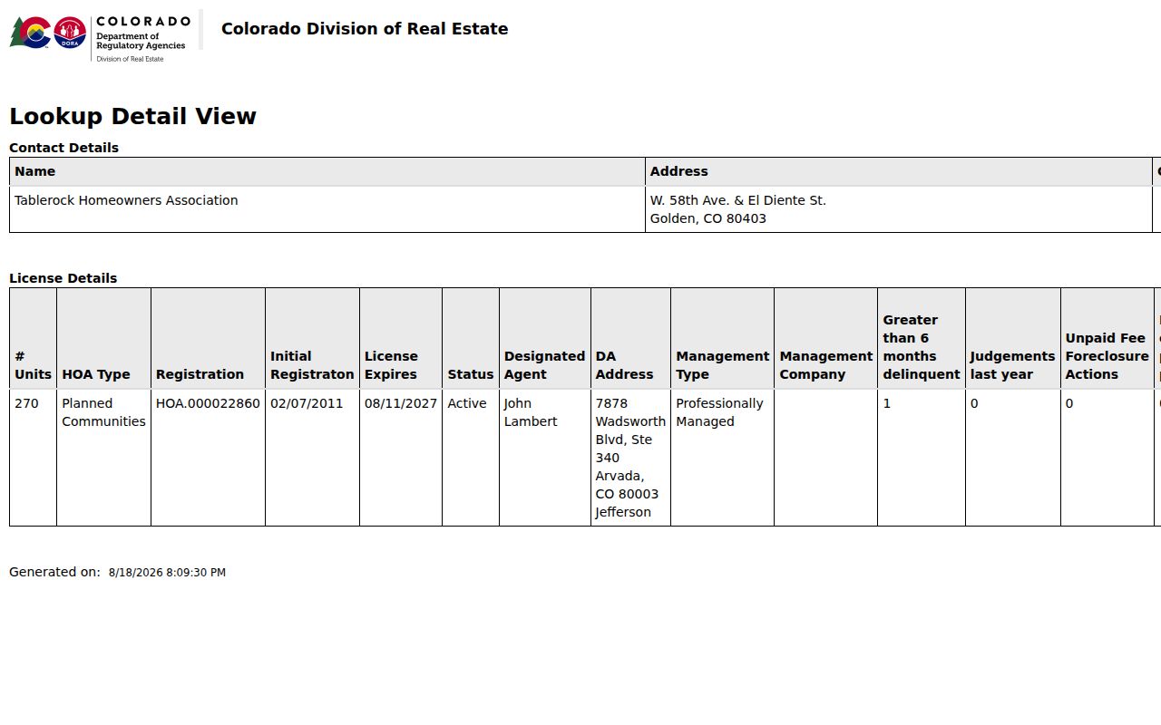
The captured license detail is an official record route, not proof of current membership, occupancy, or every address in 80403. Keep institutional records in their own category when comparing ZIP results.
Golden ZIP GIS Parcel Crosswalk
Jefferson County jMap supplies a no-login ArcGIS viewer with address, AIN/PIN, PIN/Schedule, owner-name, and street-intersection searches. Layers include parcels, streets, city and county boundaries, zoning, hazards, districts, open permits, open space, transportation, and 2006-2024 aerials. No dedicated ZIP button is visible, so a ZIP code query should name the layer, where clause, and date.
The public Jefferson parcel service exposes postal and situs fields with PIN/AIN, owner, subdivision, neighborhood, tax class, values, and sales. Golden’s address and parcel service has AddressPoints and JeffcoParcels_Unsplit. These services test geography, not certified records.
The Golden Accela license and record route shown in the manifest lists General Search, Record Number, Record Type, Project Name, start and end dates, License Type, State License Number, first and last name, business name and number, and site-address fields including city, state, and ZIP.
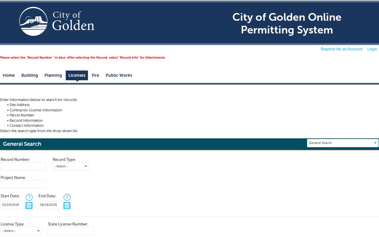
Exact record-type options, license-type options, historical cutoff, and sample records were blocked by 403 or JavaScript during capture. Use the route as an address-record lead, not as a claim that every Golden ZIP record is online.
Historic Golden Names and ZIPs
Modern ZIP labels can hide the place names used in older directories, maps, newspapers, and legal descriptions. Search Golden City, Mount Vernon, Apex, Lookout Mountain, Golden Gate Canyon or Golden Gate City, Crawford Gulch, Arapahoe City, Fairmount, Wide Acres, Genesee, Pleasant View, Leyden, and Applewood when the modern ZIP search is empty.
The Golden History Museum collection-scope guide notes that some historic communities now fall in Arvada, Wheat Ridge, or Lakewood. Pair the old name with a legal lot or parcel identifier, Sanborn map context, and a current GIS check. A modern Golden mailing label may be the last step in the crosswalk, not the first.
Golden ZIP Records Access
Online access starts with USPS, the Assessor City and Postal Code fields, GIS parcel and boundary services, and the Colorado voter lookup or county file route. A ZIP code directory request can also go to the Downtown Golden Post Office, the Assessor, GIS or City Planning, and Jefferson Elections by phone or in person. Older ZIP-less geography belongs with library, archive, museum, map, directory, and newspaper collections.
When a public service does not expose boundary history, annexation material, address maintenance, or a GIS export, use the Jefferson County CORA request process for an existing city or county record. Describe the exact address, PIN, date or election cycle, fields requested, and the conflicting official result. The county process describes an ordinary three-business-day response, a possible seven-business-day extension, and copy or research charges.
From ZIP to Golden Street
Once a ZIP is narrowed, move to the Golden by-street directory for an address-level parcel pass. Run each relevant city and ZIP combination, save the Assessor result columns, open the matching jMap geometry, and preserve the PIN, AIN, TAG, legal description, and source date.
The Recorder does not expose a ZIP filter in the researched search path. Use party, legal description, and date fields, then verify mailing and situs fields against the Assessor and GIS. A ZIP code directory result is a starting key. It becomes useful evidence only when delivery format, parcel geography, record role, and access limits remain clear.